
Freehold Township ZIP Code Coverage
The official Monmouth County ZIP list identifies 07728 as the primary postal code associated with Freehold Township. It is a starting point, not a township boundary. The county list is organized by postal community and does not draw every municipal edge. Freehold Borough and Freehold Township can share the Freehold postal city label, while an address near another community needs an address-level check. Nearby codes below are useful leads for that check, not a claim that each one serves the township.
| ZIP code | Area or postal meaning | Postal listing | Freehold Township note |
|---|---|---|---|
| 07728 | Primary code associated with Freehold Township | Freehold postal city | Shared postal geography; it does not itself prove the municipality. |
| 07726 | Englishtown area nearby | Englishtown county listing | Check a particular address before treating it as a township result. |
| 07731 | Howell area nearby | Howell county listing | Nearby code, not asserted as township-wide coverage. |
| 07746 | Marlboro area nearby | Marlboro county listing | Its edge relationship to the township was not located in official text. |
| 08527 | Jackson area nearby | Jackson county listing | Its edge relationship to the township was not located in official text. |
The defensible result is therefore a record of what USPS returns for a mailing address and what the state municipality lookup returns for the same address. A postal label is useful for mail. A municipal result identifies the local government. A parcel search supplies the property context.
Verify Freehold Township ZIP Codes
A ZIP code check begins with the full address, not a broad search for people. The official USPS ZIP Lookup is the practical postal authority for a specific mailing address. It offers an address route and city-and-state or cities-by-ZIP routes, then returns standardized postal information. USPS expressly warns that standardization does not confirm a particular person or organization at an address. Use the output as a mailing result only.
- Enter the full street address into USPS and record the standardized city, state, and ZIP result with the date checked.
- Run the same address through the New Jersey municipality lookup to see which legal municipality the geocoder returns.
- If that result is Freehold Township, use the OPRS property search with Township Name and Address, or with block and lot where available.
- Keep the postal result, municipality result, and parcel result in separate columns when an address lies near a boundary.
OPRS does not offer an inspected ZIP-wide resident filter. Once a postal check narrows the area to an address or road, the Freehold Township street directory provides the address-by-address parcel and deed workflow.
Note: A ZIP result tells where mail is routed, while a parcel result identifies the property record to inspect next.
Freehold Township ZIP Code Check Fields
The New Jersey OGIS municipality lookup is the companion civic-boundary check. It is not an ownership or resident database. Its address field uses autocomplete, it accepts an optional ZIP, and Lookup returns a municipality and standardized formatting. Use it for the legal municipality question that a Freehold postal label cannot answer on its own. If the USPS and OGIS outputs differ, preserve both and ask the relevant municipal clerk or USPS for a precise addressing answer.
| OGIS field | Input | Required | What the ZIP code check returns |
|---|---|---|---|
| Street Address | Autocomplete address text | Listed input | The starting location for municipal assignment. |
| City | Text | Listed input | Provides the postal-city context supplied with the address. |
| State | Text | Listed input | Use New Jersey for this municipality check. |
| ZIP | Text | Optional | Can accompany the address but does not replace it. |
| Lookup result | Result view | After submission | Municipality and standardized address formatting. |
The captured NJ OGIS lookup shows the address-centered municipality check used alongside a postal ZIP result.
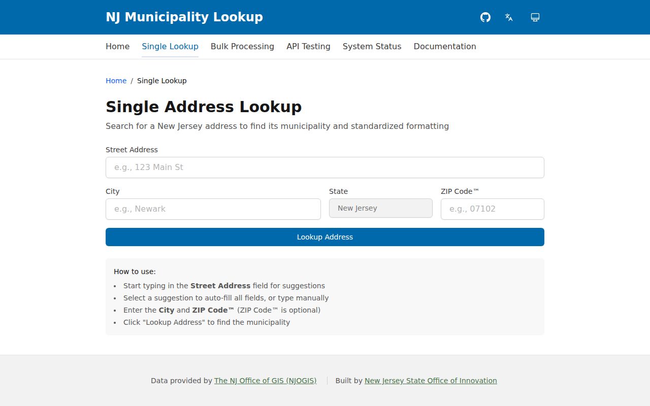
The municipality result should be retained with the postal output rather than substituted for it. One answers the municipal question; the other answers the mailing question.
Freehold Township ZIP Code Postal Quirk
07728 is a Freehold postal code, but “Freehold, NJ 07728” does not establish whether an address is in Freehold Township or Freehold Borough. This local mismatch is the key postal caution. A postal city is designed to route mail, while a municipality establishes the local governmental jurisdiction. The same written postal address can therefore be a weak clue for a municipal search unless it is checked at the address level.
Use USPS for the standardized mailing label and NJ OGIS for the municipality. When the property needs a further check, use OPRS Map & Property Info or its property routes to confirm the parcel under Freehold Township. None of these sources is a substitute for the others, and none should be turned into a blanket claim about everyone using a ZIP code.
OPRS Has No ZIP Code Filter
Freehold Township property records are organized by municipal and parcel identifiers, not by a ZIP-wide person filter. OPRS address search uses Township Name and Address. The tax-list street route uses Street Name, Township, and Year. Owner search uses Owner Name, Township, Year, and tax-exempt controls. Block-and-lot search uses parcel identifiers and a Township selection. The inspected land-record routes use municipality, dates, document type, name, or block and lot.
That design matters. Postal checking can reduce an address error, but it cannot manufacture a list of people in a postal area from OPRS. After USPS and OGIS checks, search the legally assigned municipality and the exact street or parcel. The result may identify an owner or a recorded party, each with a source date and role. It does not establish a complete list of current occupants.
Boundary check. Keep the USPS ZIP, OGIS municipality, OPRS township and parcel result, and date checked together when an address has a shared Freehold postal label.
Freehold Township ZIP Code Census Areas
Census ZIP Code Tabulation Areas, or ZCTAs, are not ZIP Codes. The U.S. Census Bureau explanation of ZCTAs says they are generalized representations built from 2020 Census blocks and USPS delivery routes. They can be noncontiguous, include enclaves, represent institutional or PO-box-only areas, and do not contain individual addresses. Census data can add area-level context, but it cannot identify a person at an address.
The Census ZCTA reference illustrates why a ZIP-shaped statistic and a postal delivery result should not be treated as the same boundary.
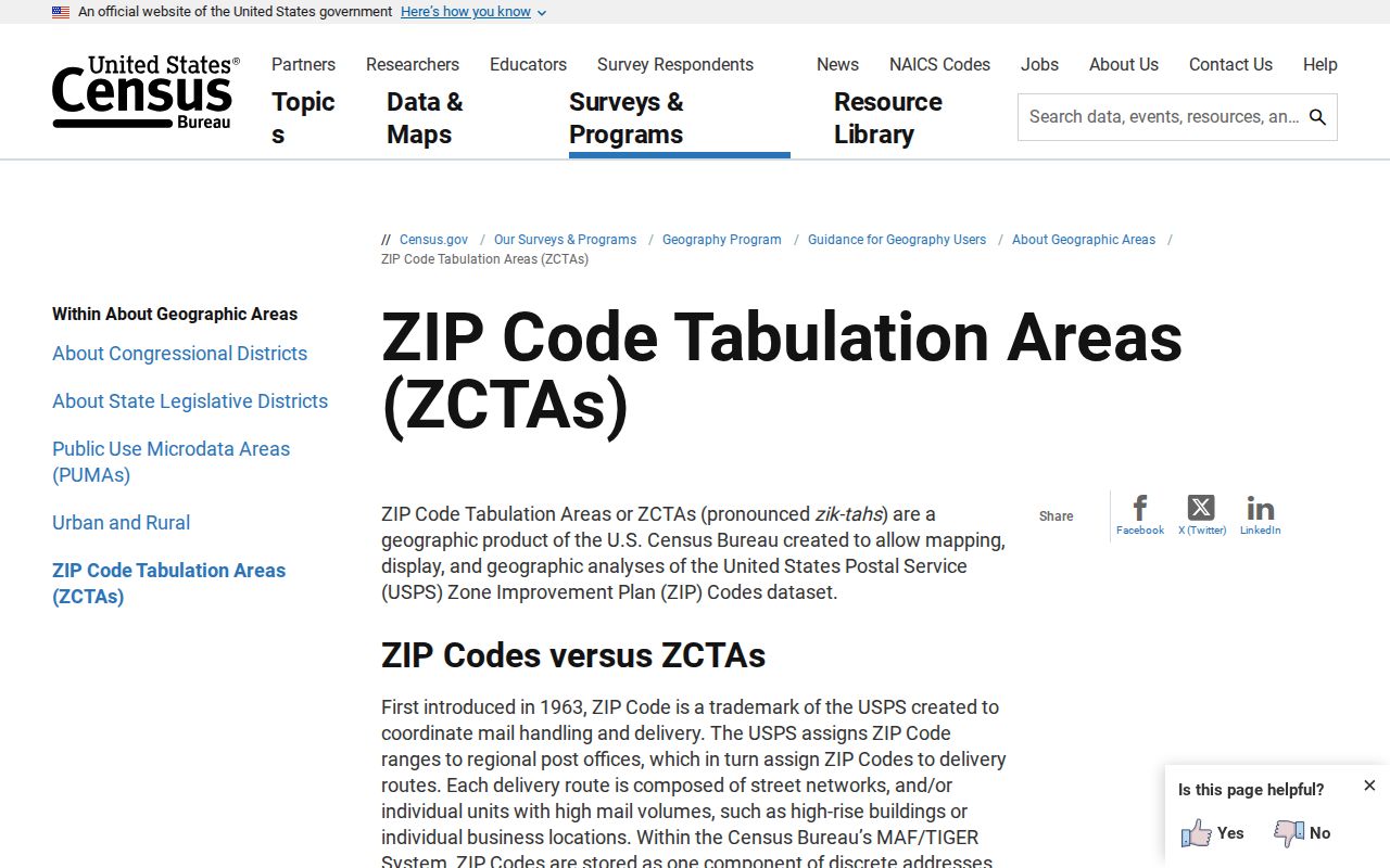
For Freehold Township, use a ZCTA only for broad statistical context. Return to USPS, OGIS, and OPRS when the task concerns a particular address, legal municipality, or parcel.
Nearby Freehold Township ZIP Code Checks
The nearby codes in the county list, 07726 for Englishtown, 07731 for Howell, 07746 for Marlboro, and 08527 for Jackson, are address-by-address verification leads. Official research did not locate a USPS or county text that maps every edge address or supplies a complete township-to-ZIP crosswalk. Do not expand a Freehold Township postal reference by guessing where one of these delivery areas ends.
When an address appears to fall near a route or municipal line, store the postal city, municipality, situs, tax mailing address, and historic jurisdiction separately. This approach is especially useful where modern roads and older record labels do not match neatly. The township’s map collection can provide road and parcel context, while the OPRS result supplies the municipal property path.
The county’s postal list is useful for a nearby-code prompt, while the New Jersey OGIS result identifies a municipality. Neither source replaces the full USPS address check that assigns the delivery ZIP.
Note: Nearby ZIPs are practical prompts to verify a full address, not evidence that a code covers all of Freehold Township.
Historic Freehold Township ZIP Code Labels
Postal geography is modern compared with Freehold Township’s record history. The township was established in 1693, and the State Archives guide identifies Freehold Township tax-ratable volumes from 1776 through 1796. One 1787 record uses Lower Freehold. A historical record may therefore carry Lower Freehold, Freehold, or Monmouth County language that does not match a modern postal label.
Search the historic jurisdiction as written, then connect it to a modern property only through a block and lot, tax-map sheet, deed legal description, or other supported record. No official modern street-renumbering or renaming chronology was located, so a mismatch should be researched through the parcel trail rather than explained away with a ZIP code.
Freehold Township ZIP Code Boundary Terms
Several similar terms appear in postal and address research. They should be defined before a Freehold Township ZIP code result is used to narrow a record search. The meanings below describe the types of result, not a verified claim that a particular special ZIP serves the township.
- ZIP Code
- A USPS delivery-routing code returned for a mailing address or postal-city search.
- ZIP+4
- An added four-digit routing detail that refines delivery within a ZIP Code; it is not a municipal boundary.
- PO-box ZIP
- A postal code used for post-office-box delivery rather than a general proof of a property’s municipal location.
- Unique ZIP
- A code assigned to a particular organization or institution; no such Freehold Township example was located in the official research.
- Carrier route
- A postal delivery grouping used for routing, distinct from a legal municipal or parcel boundary.
ZIP Code Limits in Freehold Township
No official Freehold Township ZIP split, realignment year, PO-box-only facility code, unique ZIP, or ZIP-level registration or population series was located. That absence is important. A careful postal reference should report the verified primary association and explain how to check an address, rather than invent a complete geographic roster from a partial county list.
For a public-records request, state the exact address, municipal question, date range, and desired format. The New Jersey Open Public Records Act, N.J.S.A. 47:1A-1 et seq., supplies a request framework subject to exemptions. The custodian may hold a street, parcel, or map record that resolves a specific question even when no ZIP-based search exists.